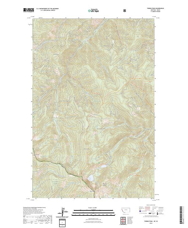
2024 Map of Torino Peak
USGS Topo · Published 2024About this map
Bitterroot Mountains define the high-elevation divide along the Montana-Idaho border, where the Lolo National Forest meets the St. Joe National Forest. This remote backcountry is characterized by sharp ridgelines like Sunset Ridge and Moore Ridge, which separate deep drainages feeding the North Fork and South Fork of Little Joe Creek. The map documents a rugged landscape punctuated by notable summits such as Torino Peak and Sunset Peak. Small alpine waters, including Diamond Lake and Cliff Lake near Eagle Cliff, serve as focal points for a network of forest routes. This modern survey details the intricate trail system, including the Stateline Trl and Dry Creek Divide Trl, tracing the topographical spine of the range.
Find a feature on this map
45 named features on this map. Tap any name to fly to it.
Don’t see what you’re looking for? This feature index may not catch every label — zoom into the map to look around manually.
Map Details
Editions of this 2024 Torino Peak Map
This is the sole edition of this map. No revisions or reprints were ever made.
Other maps of this area

1918 · St Regis
USGS Topo · 1:125,000

1919 · St. Regis
USGS Topo · 1:125,000

1956 · St Regis
USGS Topo · 1:62,500

1956 · Wallace
USGS Topo · 1:250,000

1957 · Illinois Peak
USGS Topo · 1:62,500

1957 · Haugan
USGS Topo · 1:62,500

1957 · Simmons Peak
USGS Topo · 1:62,500

1960 · Wallace
USGS Topo · 1:250,000
1988 · St Regis
USGS Topo · 1:24,000
1988 · Sherlock Peak
USGS Topo · 1:24,000