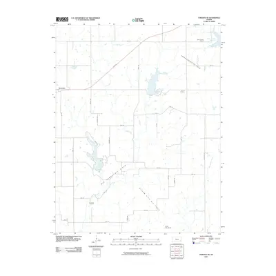
2009 Map of Toronto SE
USGS Topo · Published 2009About this map
The Yates Center Oil Field and the surrounding energy landscape dominate this part of Woodson County, revealing a rural economy deeply tied to subsurface resources. The terrain is marked by a network of local roads such as Indian Rd and Gull Rd that service the oil infrastructure and agricultural tracts. Notable rural landmarks include the Belmont Cemetery and Big Sandy Cemetery, providing important points for local family historians. Water features like Sandy Creek and the Yates Center Reservoir provide drainage across the plains, while the small settlement of Batesville sits in the northwest. The presence of the Silver City Oil Field and the Silver City Dome in the south illustrates the specialized geological focus of the area during the early 21st century.
Find a feature on this map
37 named features on this map. Tap any name to fly to it.
Don’t see what you’re looking for? This feature index may not catch every label — zoom into the map to look around manually.
Map Details
Editions of this 2009 Toronto SE Map
This is the sole edition of this map. No revisions or reprints were ever made.
Other maps of this area

1886 · Fredonia
USGS Topo · 1:125,000

1894 · Fredonia
USGS Topo · 1:125,000

1938 · Fredonia
USGS Topo · 1:62,500

1938 · Altoona
USGS Topo · 1:62,500

1939 · Altoona
USGS Topo · 1:48,000

1939 · Fredonia
USGS Topo · 1:48,000

1942 · Fredonia
USGS Topo · 1:62,500

1943 · Fredonia
USGS Topo · 1:62,500

1943 · Altoona
USGS Topo · 1:62,500

1947 · Joplin
USGS Topo · 1:250,000