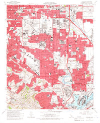
1964 Map of Torrance
USGS Topo · Published 1966About this map
Torrance and its neighboring communities in the South Bay and Harbor areas show a mid-century landscape of rapid suburban expansion and heavy industry. The map captures the industrial character of the region through massive oil refinery operations and the sprawling oil field near Carson, balanced by the rising residential developments of Avalon Village and Rolling Hills Estates. The Atchison Topeka and Santa Fe railroad and the San Diego Freeway grid provide the backbone for this economic growth, connecting the harbor's Turning Basin and West Basin to the rest of Los Angeles.
Find a feature on this map
112 named features on this map. Tap any name to fly to it.
Don’t see what you’re looking for? This feature index may not catch every label — zoom into the map to look around manually.
Map Details
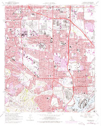
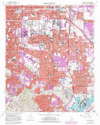
Editions of this 1964 Torrance Map
3 editions found
Other maps of this area

1896 · Redondo
USGS Topo · 1:62,500

1896 · Las Bolsas
USGS Topo · 1:62,500

1896 · San Pedro
USGS Topo · 1:62,500

1896 · Downey
USGS Topo · 1:62,500

1899 · Downey
USGS Topo · 1:62,500

1901 · Southern California Sheet No. 1
USGS Topo · 1:250,000

1902 · Downey
USGS Topo · 1:62,500

1904 · Southern California Sheet No. 1
USGS Topo · 1:250,000

1923 · Wilmington
USGS Topo · 1:24,000

1924 · Torrance
USGS Topo · 1:24,000