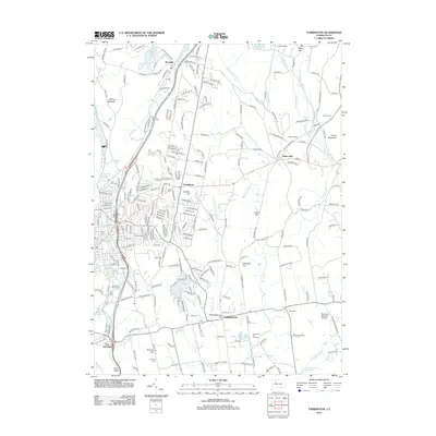
2012 Map of Torrington
USGS Topo · Published 2012About this map
The Still River and Naugatuck River valleys anchor this portrait of the Litchfield Hills, showing the complex interplay between the industrial corridor of Torrington and the surrounding rural uplands. The terrain is marked by prominent elevations like Hayden Hill and Cotton Hill, which divide the many smaller drainages including Bakersville Brook and the E Br Leadmine Brook. The map provides significant detail for genealogists, with several historic burial grounds identified, such as the Sons of Jacob Cem, New Saint Francis Cem, and Scoville Cem. To the southeast, the township of Harwinton is centered around Meetinghouse Hill, while the Harwinton Fair Grounds serves as a local landmark. Small settlements like Burrville and Bakersville remain distinct among the expanding road networks, and specialized sites like the Mountain Meadow Airstrip and Burr Pond state parkland illustrate the area's mix of private aviation and public recreation.
Find a feature on this map
249 named features on this map. Tap any name to fly to it.
Don’t see what you’re looking for? This feature index may not catch every label — zoom into the map to look around manually.
Map Details
Editions of this 2012 Torrington Map
This is the sole edition of this map. No revisions or reprints were ever made.
Other maps of this area

1892 · Winsted
USGS Topo · 1:62,500

1892 · Meriden
USGS Topo · 1:62,500

1892 · Granby
USGS Topo · 1:62,500

1893 · Waterbury
USGS Topo · 1:62,500

1893 · Meriden
USGS Topo · 1:62,500

1904 · Waterbury
USGS Topo · 1:62,500

1904 · Litchfield
USGS Topo · 1:125,000

1906 · Farmington
USGS Topo · 1:125,000

1946 · Bristol
USGS Topo · 1:31,680

1947 · Hartford
USGS Topo · 1:250,000