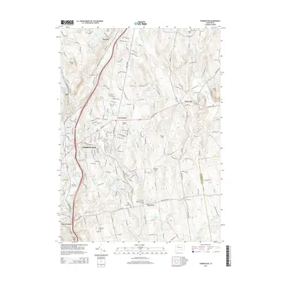
2015 Map of Torrington
USGS Topo · Published 2015About this map
Torrington occupies a central role in this landscape of the Litchfield Hills, where the Naugatuck River and its various tributaries have shaped the development of the region. The map reveals a dense network of suburban expansion and industrial legacies, bordered by the quieter reaches of Bakersville and Burrville. Local history is anchored by several long-standing burial grounds, including the Sons of Jacob Cem and New Saint Francis Cem. Water resources dominate the terrain, from the East Branch Naugatuck River Reservoir in the west to Lake Harwinton in the south. The elevation rises toward several significant peaks such as Burr Mtn and Walnut Mtn, while the boundary between Litchfield County and Hartford County cuts through the eastern hills near Yellow Mtn.
Find a feature on this map
204 named features on this map. Tap any name to fly to it.
Don’t see what you’re looking for? This feature index may not catch every label — zoom into the map to look around manually.
Map Details
Editions of this 2015 Torrington Map
This is the sole edition of this map. No revisions or reprints were ever made.
Other maps of this area

1892 · Winsted
USGS Topo · 1:62,500

1892 · Meriden
USGS Topo · 1:62,500

1892 · Granby
USGS Topo · 1:62,500

1893 · Waterbury
USGS Topo · 1:62,500

1893 · Meriden
USGS Topo · 1:62,500

1904 · Waterbury
USGS Topo · 1:62,500

1904 · Litchfield
USGS Topo · 1:125,000

1906 · Farmington
USGS Topo · 1:125,000

1946 · Bristol
USGS Topo · 1:31,680

1947 · Hartford
USGS Topo · 1:250,000