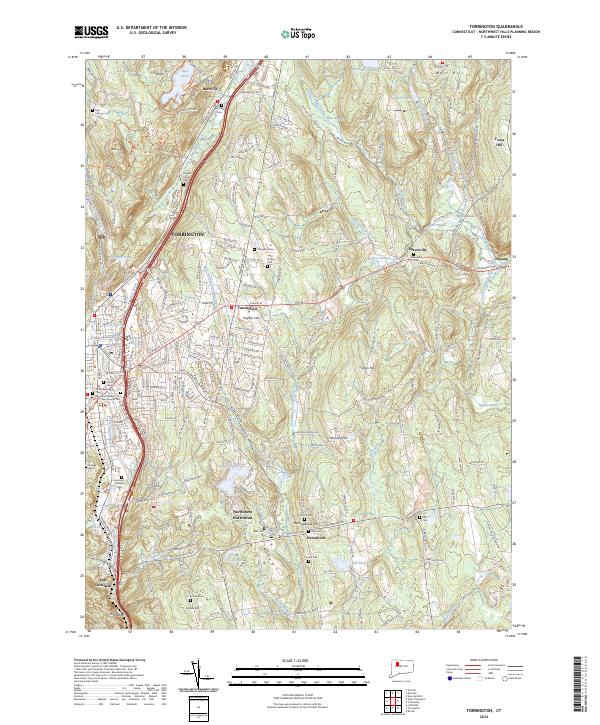
2024 Map of Torrington
USGS Topo · Published 2024About this map
Torrington serves as the industrial and social hub of this landscape, where the Naugatuck River and Still River converge. The urban center is dense with civic and spiritual landmarks, including the Trinity Episcopal Church and the Memorial Garden. Moving away from the city core, the terrain transitions into a mosaic of small villages and rural uplands. To the north, Burrville sits near the shores of Burr Pond, while to the southeast, the residential clusters of Harwinton and Northwest Harwinton are defined by historic cemeteries such as the Old Cem and North Cem.
Find a feature on this map
224 named features on this map. Tap any name to fly to it.
Don’t see what you’re looking for? This feature index may not catch every label — zoom into the map to look around manually.
Map Details
Editions of this 2024 Torrington Map
This is the sole edition of this map. No revisions or reprints were ever made.
Other maps of this area

1892 · Winsted
USGS Topo · 1:62,500

1892 · Meriden
USGS Topo · 1:62,500

1892 · Granby
USGS Topo · 1:62,500

1893 · Waterbury
USGS Topo · 1:62,500

1893 · Meriden
USGS Topo · 1:62,500

1904 · Waterbury
USGS Topo · 1:62,500

1904 · Litchfield
USGS Topo · 1:125,000

1906 · Farmington
USGS Topo · 1:125,000

1946 · Bristol
USGS Topo · 1:31,680

1947 · Hartford
USGS Topo · 1:250,000