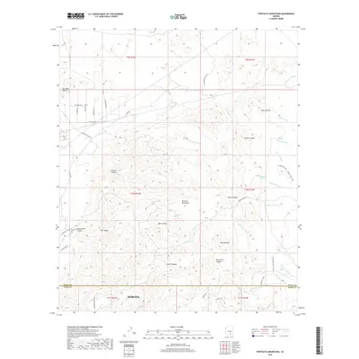
2018 Map of Tortolita Mountains
USGS Topo · Published 2018About this map
Marana anchors the southern edge of this survey, where the desert floor meets the rising peaks of the Tortolita Mountains. The landscape is defined by a complex network of ephemeral drainages, including Guild Wash and Indian Well Wash, which channel seasonal water from high points like Jeffords Peak and the Falcon Divide. This 2018 study reveals a region where traditional ranching roots, evidenced by names like S McQueen Ranch Rd and S Carpenter Ranch Rd, coexist with modern recreational infrastructure such as the Honeybee Canyon Loop and Loop Trail.
Find a feature on this map
52 named features on this map. Tap any name to fly to it.
Don’t see what you’re looking for? This feature index may not catch every label — zoom into the map to look around manually.
Map Details
Editions of this 2018 Tortolita Mountains Map
This is the sole edition of this map. No revisions or reprints were ever made.
Other maps of this area

1904 · Tucson
USGS Topo · 1:125,000

1905 · Tucson
USGS Topo · 1:125,000

1911 · Winkelman
USGS Topo · 1:125,000

1913 · Winkelman
USGS Topo · 1:125,000

1934 · Tucson Mountains
USGS Topo · 1:125,000

1934 · Newman Peak
USGS Topo · 1:125,000

1947 · Cortaro
USGS Topo · 1:62,500

1956 · Tucson
USGS Topo · 1:250,000

1957 · Cortaro
USGS Topo · 1:62,500
1957 · Mount Lemmon
USGS Topo · 1:62,500