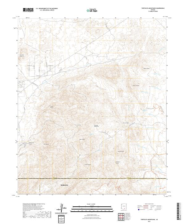
2021 Map of Tortolita Mountains
USGS Topo · Published 2021About this map
Tortolita Mountains topography dominates this 2021 survey, where the arid landscape of the Sonoran Desert transitions between the peaks and numerous seasonal drainages. The southern portion of the sheet reaches the northern outskirts of Marana at the boundary of Pinal and Pima Counties. A network of backcountry routes and trails, including the North Mountain Park Trl and Window Rock Loop Trl, navigates the complex elevation changes around Jeffords Peak.
Find a feature on this map
57 named features on this map. Tap any name to fly to it.
Don’t see what you’re looking for? This feature index may not catch every label — zoom into the map to look around manually.
Map Details
Editions of this 2021 Tortolita Mountains Map
This is the sole edition of this map. No revisions or reprints were ever made.
Other maps of this area

1904 · Tucson
USGS Topo · 1:125,000

1905 · Tucson
USGS Topo · 1:125,000

1911 · Winkelman
USGS Topo · 1:125,000

1913 · Winkelman
USGS Topo · 1:125,000

1934 · Tucson Mountains
USGS Topo · 1:125,000

1934 · Newman Peak
USGS Topo · 1:125,000

1947 · Cortaro
USGS Topo · 1:62,500

1956 · Tucson
USGS Topo · 1:250,000

1957 · Cortaro
USGS Topo · 1:62,500
1957 · Mount Lemmon
USGS Topo · 1:62,500