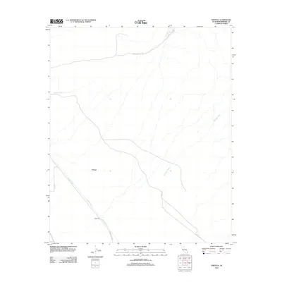
2012 Map of Tortuga
USGS Topo · Published 2012About this map
Coachella Canal dominates the southwestern portion of this California desert landscape, providing a stark engineering line through the arid terrain of Imperial County. This irrigation infrastructure is flanked by the Coachella Canal Rd and punctuated by water control features like Siphon One and Siphon Three. The settlement of Tortuga sits along the canal, serving as a focal point in a region characterized by expansive drainage systems. The natural landscape is defined by the broad, braided paths of Mammoth Wash, which cuts diagonally across the eastern half of the map. Roadways such as Niland-Pegleg Well Rd and Ted Kiff Rd provide a network for transit through the open desert, connecting remote outposts and water management sites in a region where water transport is the primary driver of human activity.
Find a feature on this map
10 named features on this map. Tap any name to fly to it.
Don’t see what you’re looking for? This feature index may not catch every label — zoom into the map to look around manually.
Map Details
Editions of this 2012 Tortuga Map
This is the sole edition of this map. No revisions or reprints were ever made.
Other maps of this area

1940 · Iris
USGS Topo · 1:62,500

1940 · Iris Pass
USGS Topo · 1:62,500

1945 · Iris Pass
USGS Topo · 1:62,500

1945 · Iris
USGS Topo · 1:62,500

1953 · Acolita
USGS Topo · 1:24,000

1953 · Chuckwalla Spring
USGS Topo · 1:62,500

1953 · Acolita
USGS Topo · 1:62,500

1954 · Salton Sea
USGS Topo · 1:250,000

1955 · Tortuga
USGS Topo · 1:24,000

1955 · Salton Sea
USGS Topo · 1:250,000