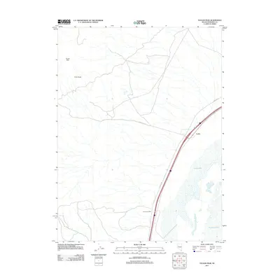
2011 Map of Toulon Peak
USGS Topo · Published 2011About this map
Toulon and the surrounding high desert of Pershing County are defined by the stark contrast between the arid slopes of the Trinity Range and the life-giving waters of the Humboldt Sink. This landscape is anchored by Toulon Peak, which overlooks a network of transportation routes including the modern Interstate corridor and the older Ragged Top Rd. The map illustrates a critical hydrological intersection where Toulon Spring provides a rare upland water source above the expansive basins of Toulon Lake and Humboldt Lake. This area reflects the persistent importance of water and transit in the Great Basin, with the location of Browns Post Office serving as a tangible marker of the region's historical postal and settlement network alongside the rail-aligned community of Toulon.
Find a feature on this map
9 named features on this map. Tap any name to fly to it.
Don’t see what you’re looking for? This feature index may not catch every label — zoom into the map to look around manually.
Map Details
Editions of this 2011 Toulon Peak Map
This is the sole edition of this map. No revisions or reprints were ever made.
Other maps of this area

1908 · Carson Sink
USGS Topo · 1:250,000

1910 · Carson Sink
USGS Topo · 1:250,000

1931 · Lovelock
USGS Topo · 1:250,000

1935 · Lovelock
USGS Topo · 1:250,000

1951 · Carson Sink
USGS Topo · 1:62,500

1951 · Desert Peak
USGS Topo · 1:62,500

1955 · Lovelock
USGS Topo · 1:250,000

1956 · Toulon
USGS Topo · 1:62,500

1957 · Reno
USGS Topo · 1:250,000

1959 · Lovelock
USGS Topo · 1:250,000