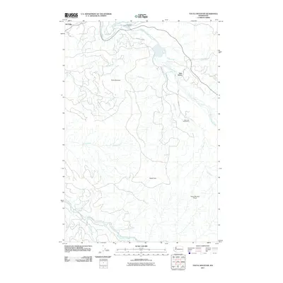
2011 Map of Toutle Mountain
USGS Topo · Published 2011About this map
Toutle Mountain and the surrounding peaks of the Toutle Mountain Range dominate this portion of the Pacific Northwest, captured in 2011. The landscape is defined by the complex drainage systems of the North Fork Toutle River and South Fork Toutle River, where the local economy and ecology are tightly linked to the water. The presence of the Green River Salmon Hatchery and the Alder Creek Rearing Pond underscores the region's commitment to fishery management along the Green River. Small settlements such as Kid Valley and Saint Helens provide anchors for the network of mountain roads, including Wild Cat Rd and Sediment Dam Rd. These corridors navigate a terrain of steep ridges and creek valleys, including Johnson Creek and Stiltz Creek, leading toward high points like Signal Peak.
Find a feature on this map
20 named features on this map. Tap any name to fly to it.
Don’t see what you’re looking for? This feature index may not catch every label — zoom into the map to look around manually.
Map Details
Editions of this 2011 Toutle Mountain Map
This is the sole edition of this map. No revisions or reprints were ever made.
Other maps of this area

1919 · Mount St Helens
USGS Topo · 1:125,000

1942 · Toutle
USGS Topo · 1:62,500

1943 · Pigeon Springs
USGS Topo · 1:62,500

1953 · Hoquiam
USGS Topo · 1:250,000

1953 · Toutle
USGS Topo · 1:62,500

1953 · Pigeon Springs
USGS Topo · 1:62,500

1953 · Cougar
USGS Topo · 1:62,500

1953 · Elk Rock
USGS Topo · 1:62,500

1957 · Hoquiam
USGS Topo · 1:250,000

1958 · Hoquiam
USGS Topo · 1:250,000