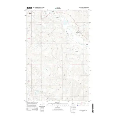
2013 Map of Toutle Mountain
USGS Topo · Published 2013About this map
Kid Valley and Saint Helens occupy a landscape defined by the drainage basins of the North Fork Toutle River and South Fork Toutle River. This 2013 survey illustrates the area's continued focus on natural resource management and conservation, notably shown through the Green River Salmon Hatchery and the Alder Creek Rearing Pond. The presence of Sediment Dam Rd points to the environmental engineering efforts following volcanic activity in the Toutle Mountain Range. High elevations are dominated by Toutle Mtn and Signal Peak, while the lowland areas like Maple Flat provide a contrast to the surrounding ridges. Remote outposts such as Camp Baker are reached by local connectors like Parker Rd and Pauly Rd, threading between numerous named creeks including Pullen Creek and Johnson Cr.
Find a feature on this map
32 named features on this map. Tap any name to fly to it.
Don’t see what you’re looking for? This feature index may not catch every label — zoom into the map to look around manually.
Map Details
Editions of this 2013 Toutle Mountain Map
This is the sole edition of this map. No revisions or reprints were ever made.
Other maps of this area

1919 · Mount St Helens
USGS Topo · 1:125,000

1942 · Toutle
USGS Topo · 1:62,500

1943 · Pigeon Springs
USGS Topo · 1:62,500

1953 · Hoquiam
USGS Topo · 1:250,000

1953 · Toutle
USGS Topo · 1:62,500

1953 · Pigeon Springs
USGS Topo · 1:62,500

1953 · Cougar
USGS Topo · 1:62,500

1953 · Elk Rock
USGS Topo · 1:62,500

1957 · Hoquiam
USGS Topo · 1:250,000

1958 · Hoquiam
USGS Topo · 1:250,000