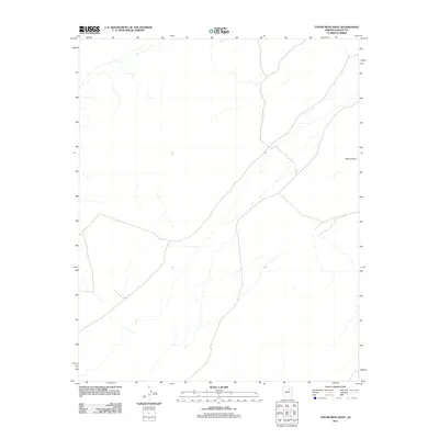
2011 Map of Tovar Mesa West
USGS Topo · Published 2011About this map
Elbow Point stands as a prominent terrain feature on this 2011 survey of Navajo County, Arizona. Located within the high desert landscape, the map reveals a vast network of ephemeral washes and drainage patterns that characterize this arid region. The lack of dense settlement or named structural developments underscores the open, undisturbed nature of the territory during the early 21st century. Instead, the focus remains on the natural topography and the subtle relief of the mesas, providing a clear record of the physical geography before any significant modern encroachment or infrastructure changes. This quadrangle captures the essential character of the Arizona backcountry, defined primarily by its hydrological features and natural landmarks.
Find a feature on this map
1 named feature on this map. Tap any name to fly to it.
Don’t see what you’re looking for? This feature index may not catch every label — zoom into the map to look around manually.
Map Details
Editions of this 2011 Tovar Mesa West Map
This is the sole edition of this map. No revisions or reprints were ever made.
Other maps of this area

1883 · Tusayan
USGS Topo · 1:250,000

1886 · Tusayan
USGS Topo · 1:250,000

1947 · Flagstaff
USGS Topo · 1:250,000

1954 · Flagstaff
USGS Topo · 1:250,000

1955 · Leupp
USGS Topo · 1:62,500

1958 · Flagstaff
USGS Topo · 1:250,000

1960 · Flagstaff
USGS Topo · 1:250,000

1962 · Flagstaff
USGS Topo · 1:250,000

1966 · Tovar Mesa
USGS Topo · 1:62,500
1967 · Garces Mesas SE
USGS Topo · 1:24,000