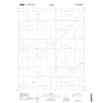
2018 Map of Tovar Mesa West
USGS Topo · Published 2018About this map
Tovar Mesa rises as a prominent high-desert landform within the Navajo Nation, anchoring the landscape of this Navajo County survey. The terrain is characterized by the expansive drainages of Polacca Wash in the southwest, where seasonal water flow has historically shaped the agricultural and settlement patterns of the region. Transportation across this arid expanse is facilitated by established routes such as Indian Rte 18 and Indian Rte 11, which connect the high points like Elbow Point to broader networks. The mapping highlights the intersection of several townships and ranges, providing a clear view of the public land survey system as it applies to this section of the Arizona desert.
Find a feature on this map
11 named features on this map. Tap any name to fly to it.
Don’t see what you’re looking for? This feature index may not catch every label — zoom into the map to look around manually.
Map Details
Editions of this 2018 Tovar Mesa West Map
This is the sole edition of this map. No revisions or reprints were ever made.
Other maps of this area

1883 · Tusayan
USGS Topo · 1:250,000

1886 · Tusayan
USGS Topo · 1:250,000

1947 · Flagstaff
USGS Topo · 1:250,000

1954 · Flagstaff
USGS Topo · 1:250,000

1955 · Leupp
USGS Topo · 1:62,500

1958 · Flagstaff
USGS Topo · 1:250,000

1960 · Flagstaff
USGS Topo · 1:250,000

1962 · Flagstaff
USGS Topo · 1:250,000

1966 · Tovar Mesa
USGS Topo · 1:62,500
1967 · Garces Mesas SE
USGS Topo · 1:24,000