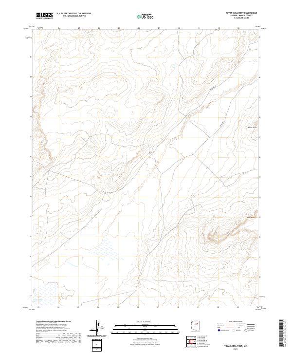
2021 Map of Tovar Mesa West
USGS Topo · Published 2021About this map
Tovar Mesa dominates the eastern portion of this high desert landscape in Navajo County, characterized by the dramatic relief of Elbow Point. The intermittent drainage of Polacca Wash cuts through the southwestern corner, reflecting the seasonal hydrology of the region. The map reveals a remote environment structured by the Public Land Survey System, with township and range lines like t26n r15e and t25n r16e organizing the vast open spaces. Transportation is limited to established routes such as Indian Rte 18 and Indian Rte 11, which provide the primary access through this sparsely populated terrain. The topographic detail highlights the intricate contouring of mesa edges and dry washes, typical of the arid geography found within this part of the Southwest.
Find a feature on this map
11 named features on this map. Tap any name to fly to it.
Don’t see what you’re looking for? This feature index may not catch every label — zoom into the map to look around manually.
Map Details
Editions of this 2021 Tovar Mesa West Map
This is the sole edition of this map. No revisions or reprints were ever made.
Other maps of this area

1883 · Tusayan
USGS Topo · 1:250,000

1886 · Tusayan
USGS Topo · 1:250,000

1947 · Flagstaff
USGS Topo · 1:250,000

1954 · Flagstaff
USGS Topo · 1:250,000

1955 · Leupp
USGS Topo · 1:62,500

1958 · Flagstaff
USGS Topo · 1:250,000

1960 · Flagstaff
USGS Topo · 1:250,000

1962 · Flagstaff
USGS Topo · 1:250,000

1966 · Tovar Mesa
USGS Topo · 1:62,500
1967 · Garces Mesas SE
USGS Topo · 1:24,000