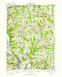
1923 Map of Towanda
USGS Topo · Published 1923About this map
The Susquehanna River carves a deep valley through Bradford County, anchoring the commercial and transport life of the region during the early 1920s. Along its banks, the Lehigh Valley railroad serves the major hub of Towanda, while smaller communities like North Towanda and East Towanda cluster around the river crossings. The upland plateaus are defined by a dense network of rural one-room schoolhouses, such as Cottonhollow School, Park Hollow School, and Ballibay School, reflecting the era's decentralized education system for farming families.
Find a feature on this map
84 named features on this map. Tap any name to fly to it.
Don’t see what you’re looking for? This feature index may not catch every label — zoom into the map to look around manually.
Map Details
Editions of this 1923 Towanda Map
This is the sole edition of this map. No revisions or reprints were ever made.
Other maps of this area
1901 · Apalachin
USGS Topo · 1:62,500
1902 · Waverly
USGS Topo · 1:62,500
1903 · Owego
USGS Topo · 1:62,500
1904 · Apalachin
USGS Topo · 1:62,500

1905 · Watkins Glen
USGS Topo · 1:125,000
1906 · Catatonk
USGS Topo · 1:125,000
1926 · Towanda
USGS Topo · 1:62,500
1939 · Sayre
USGS Topo · 1:62,500
1942 · Sayre
USGS Topo · 1:62,500
1943 · Towanda
USGS Topo · 1:62,500