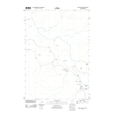
2012 Map of Tower Junction
USGS Topo · Published 2012About this map
Tower Junction serves as the focal point for this rugged interior landscape where the Yellowstone River and Lamar River converge. The area is characterized by dramatic geological formations, including the Grand Canyon of the Yellowstone and the sheer vertical drop of Tower Fall. Historic travel and habitation patterns are evident at Yanceys and the Roosevelt Lodge, which sit near the intersection of the Grand Loop Rd and Blacktail Plateau Dr. The map detail highlights important river crossings such as Buffalo Ford and Bannock Ford, which were historically significant for both native migration and early explorers. From the steep walls of The Narrows and the Overhanging Cliff to the geothermal activity at Calcite Springs, the topography reflects a diverse ecosystem where high-altitude lakes like Floating Island Lake and Rainy Lake dot the plateau above the river canyons.
Find a feature on this map
39 named features on this map. Tap any name to fly to it.
Don’t see what you’re looking for? This feature index may not catch every label — zoom into the map to look around manually.
Map Details
Editions of this 2012 Tower Junction Map
This is the sole edition of this map. No revisions or reprints were ever made.
Other maps of this area

1885 · Gallatin
USGS Topo · 1:125,000

1885 · Gallatin
USGS Topo · 1:125,000

1886 · Canyon
USGS Topo · 1:125,000

1891 · Livingston
USGS Topo · 1:250,000

1893 · Livingston
USGS Topo · 1:250,000

1895 · Canyon
USGS Topo · 1:125,000

1896 · Canyon
USGS Topo · 1:125,000

1901 · Canyon
USGS Topo · 1:125,000

1901 · Gallatin
USGS Topo · 1:125,000

1907 · Canyon
USGS Topo · 1:125,000