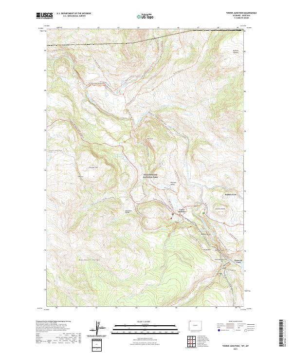
2021 Map of Tower Junction
USGS Topo · Published 2021About this map
Tower Junction serves as the central hub for this portion of Yellowstone National Park, where the Grand Loop Road - Tower-Mammoth meets the NE Entrance Road. This area is defined by the dramatic confluence of the Yellowstone River and the Lamar River, cutting through the Black Canyon of the Yellowstone and the Grand Canyon of the Yellowstone. The map reveals a landscape heavily navigated by horse and foot, documented through an extensive network of trails including the Two Hour Horse Ride Trl and One Hour Horse Ride Trl near Pleasant Valley. Historical river crossings like Buffalo Ford and Bannock Ford indicate long-standing transit points across the water. Notable geological features like Overhanging Cliff, The Narrows, and The Needle emphasize the verticality of the terrain between the Washburn Range and the Buffalo Plateau. Thermal activity is noted at Calcite Springs and Nymph Spring, while smaller water bodies like Floating Island Lake and Lost Lake dot the higher ground.
Find a feature on this map
66 named features on this map. Tap any name to fly to it.
Don’t see what you’re looking for? This feature index may not catch every label — zoom into the map to look around manually.
Map Details
Editions of this 2021 Tower Junction Map
This is the sole edition of this map. No revisions or reprints were ever made.
Other maps of this area

1885 · Gallatin
USGS Topo · 1:125,000

1885 · Gallatin
USGS Topo · 1:125,000

1886 · Canyon
USGS Topo · 1:125,000

1891 · Livingston
USGS Topo · 1:250,000

1893 · Livingston
USGS Topo · 1:250,000

1895 · Canyon
USGS Topo · 1:125,000

1896 · Canyon
USGS Topo · 1:125,000

1901 · Canyon
USGS Topo · 1:125,000

1901 · Gallatin
USGS Topo · 1:125,000

1907 · Canyon
USGS Topo · 1:125,000