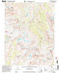
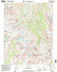
2001 Map of Tower Peak
USGS Topo · Published 2004About this map
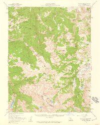
Tower Peak rises at the convergence of several wilderness boundaries, marking a point where the Yosemite National Park and Stanislaus National Forest meet. This high-altitude landscape is defined by its glaciated basins and an extensive network of alpine water bodies, including Mary Lake, Dorothy Lake, and the Chain of Lakes. The drainage patterns are clearly visible as the West Walker River flows north through Walker Meadows, while Jack Main Canyon Creek and Tilden Creek head south into the park. Human presence in this environment is sparse and functional, centered on long-distance travel and extraction. The Pacific Crest National Scenic Trail winds through the central corridor, passing landmarks like Piute Cabin. Evidence of early resource exploration is found at the Prospect site near Summit Meadow, indicating the area's history of mineral survey work amidst the granite ridges of the Saurian Crest and Montezuma Ridge.
Find a feature on this map
66 named features on this map. Tap any name to fly to it.
Don’t see what you’re looking for? This feature index may not catch every label — zoom into the map to look around manually.
Map Details
Editions of this 2001 Tower Peak Map
2 editions found
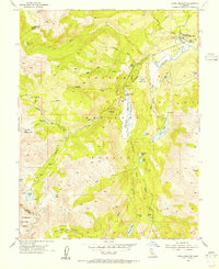
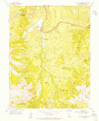
Other maps of this area

1896 · Dardanelles
USGS Topo · 1:125,000

1898 · Dardanelles
USGS Topo · 1:125,000

1909 · Bridgeport
USGS Topo · 1:125,000

1911 · Bridgeport
USGS Topo · 1:125,000

1920 · Bridgeport
USGS Topo · 1:125,000

1948 · Walker Lake
USGS Topo · 1:250,000
1954 · Pickel Meadow
USGS Topo · 1:24,000
1954 · Fales Hot Springs
USGS Topo · 1:24,000
1956 · Sonora Pass
USGS Topo · 1:62,500
1956 · Fales Hot Springs
USGS Topo · 1:62,500