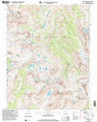
2001 Map of Tower Peak
USGS Topo · Published 2004About this map
Montezuma Mine sits near the western boundary of this high-altitude landscape, marking a point of industrial interest within the Stanislaus National Forest. The terrain is defined by the dramatic crests of the Sierra Nevada, where the headwaters of the West Walker River originate near Walker Meadows. This area serves as a significant hydraulic and geographic hub, with water flowing through a complex network of alpine lakes such as Dorothy Lake, Mary Lake, and the Chain of Lakes.
Find a feature on this map
59 named features on this map. Tap any name to fly to it.
Don’t see what you’re looking for? This feature index may not catch every label — zoom into the map to look around manually.
Map Details
Editions of this 2001 Tower Peak Map
2 editions found
Other maps of this area

1896 · Dardanelles
USGS Topo · 1:125,000

1898 · Dardanelles
USGS Topo · 1:125,000

1909 · Bridgeport
USGS Topo · 1:125,000

1911 · Bridgeport
USGS Topo · 1:125,000

1920 · Bridgeport
USGS Topo · 1:125,000

1948 · Walker Lake
USGS Topo · 1:250,000

1954 · Pickel Meadow
USGS Topo · 1:24,000

1954 · Fales Hot Springs
USGS Topo · 1:24,000

1956 · Sonora Pass
USGS Topo · 1:62,500

1956 · Fales Hot Springs
USGS Topo · 1:62,500