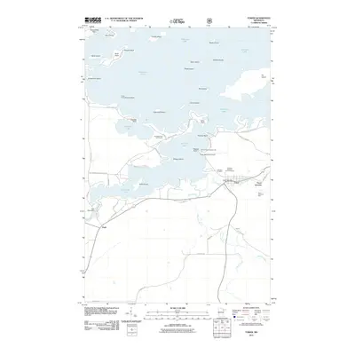
2011 Map of Tower
USGS Topo · Published 2011About this map
Vermilion Lake dominates this landscape, its intricate shoreline defined by numerous islands and points like Birch Island and Everetts Point. The settlement of Tower serves as a focal point near the southern shore, situated where the East Two River and West Two River converge. This area reflects a legacy of northern Minnesota industry and transit, evidenced by the North American Mine and the unique Irons Point Seaplane Base.
Find a feature on this map
63 named features on this map. Tap any name to fly to it.
Don’t see what you’re looking for? This feature index may not catch every label — zoom into the map to look around manually.
Map Details
Editions of this 2011 Tower Map
This is the sole edition of this map. No revisions or reprints were ever made.
Other maps of this area

1949 · Embarrass
USGS Topo · 1:24,000

1950 · Embarrass
USGS Topo · 1:24,000

1950 · Biwabik NW
USGS Topo · 1:24,000

1950 · Biwabik NE
USGS Topo · 1:24,000

1951 · Biwabik NE
USGS Topo · 1:24,000

1951 · Biwabik NW
USGS Topo · 1:24,000

1954 · Hibbing
USGS Topo · 1:250,000

1956 · Sioux Pine Island
USGS Topo · 1:24,000

1956 · Tower
USGS Topo · 1:24,000

1956 · Vermilion Dam
USGS Topo · 1:24,000