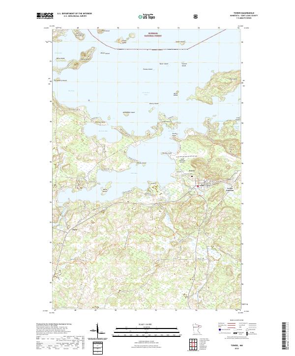
2022 Map of Tower
USGS Topo · Published 2022About this map
Vermilion Lake dominates the northern reaches of this Iron Range landscape, where the town of Tower serves as a gateway to the Superior National Forest. The complex shoreline is defined by numerous landforms including Birch Point, Hoodoo Point, and the large expanse of Pine Island. To the south, the settlement of Peyla and the Tower Junction area show the terrestrial footprint of the region, anchored by the Pike River and West Two River systems. Local history is evidenced at Lakeview Cem near the Tower Municipal Airport, while the grid of roads such as Main St and Bessin Hwy 42 connect the lakeside communities. The map highlights the transition from the protected forest wilderness to the structured layouts of these northern Minnesota townships.
Find a feature on this map
87 named features on this map. Tap any name to fly to it.
Don’t see what you’re looking for? This feature index may not catch every label — zoom into the map to look around manually.
Map Details
Editions of this 2022 Tower Map
This is the sole edition of this map. No revisions or reprints were ever made.
Other maps of this area

1949 · Embarrass
USGS Topo · 1:24,000

1950 · Embarrass
USGS Topo · 1:24,000

1950 · Biwabik NW
USGS Topo · 1:24,000

1950 · Biwabik NE
USGS Topo · 1:24,000

1951 · Biwabik NE
USGS Topo · 1:24,000

1951 · Biwabik NW
USGS Topo · 1:24,000

1954 · Hibbing
USGS Topo · 1:250,000

1956 · Sioux Pine Island
USGS Topo · 1:24,000

1956 · Tower
USGS Topo · 1:24,000

1956 · Vermilion Dam
USGS Topo · 1:24,000