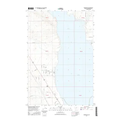
2017 Map of Townsend NE
USGS Topo · Published 2017About this map
Canyon Ferry Lake dominates this central Montana landscape, where the water's edge meets the residential development of Canton and The Silos. The area's agricultural and ranching legacy is etched into the grid by numerous roads bearing family and mining-themed names like A B Cook Rd, Paydirt, and Quartz Rd. To the north, the Broadwater-Missouri Canal follows the eastern shoreline near Horse Cr, illustrating the sophisticated irrigation infrastructure required for high-plains cultivation. Local history is anchored by the Fairview Cem on the eastern bluffs and the Canyon Ferry Airport near the water, while natural features like Antelope Springs and Whitehorse Cr hint at the original terrain that drew early settlers to the Missouri River valley before the reservoir's creation.
Find a feature on this map
39 named features on this map. Tap any name to fly to it.
Don’t see what you’re looking for? This feature index may not catch every label — zoom into the map to look around manually.
Map Details
Editions of this 2017 Townsend NE Map
This is the sole edition of this map. No revisions or reprints were ever made.
Other maps of this area

1886 · Fort Logan
USGS Topo · 1:250,000

1948 · White Sulphur Springs
USGS Topo · 1:250,000

1950 · Canyon Ferry
USGS Topo · 1:62,500

1950 · Townsend
USGS Topo · 1:62,500

1950 · Duck Creek Pass
USGS Topo · 1:62,500

1958 · White Sulphur Springs
USGS Topo · 1:250,000

1961 · White Sulphur Springs
USGS Topo · 1:250,000

1965 · White Sulphur Springs
USGS Topo · 1:250,000

1966 · Diamond City
USGS Topo · 1:24,000
1972 · Canyon Ferry SW
USGS Topo · 1:24,000