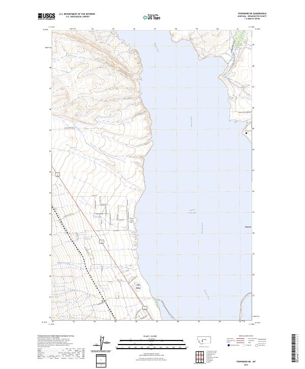
2024 Map of Townsend NE
USGS Topo · Published 2024About this map
Canyon Ferry Lake dominates this central Montana landscape, where the Missouri River flows through a valley defined by irrigation and early mining history. The settlement of Canton sits on the eastern shore, a remnant of a community established in the 1870s that was largely relocated or submerged as the reservoir rose. On the western bank, The Silos and the nearby Canyon Ferry Airport mark contemporary hubs of activity along the water's edge.
Find a feature on this map
41 named features on this map. Tap any name to fly to it.
Don’t see what you’re looking for? This feature index may not catch every label — zoom into the map to look around manually.
Map Details
Editions of this 2024 Townsend NE Map
This is the sole edition of this map. No revisions or reprints were ever made.
Other maps of this area

1886 · Fort Logan
USGS Topo · 1:250,000

1948 · White Sulphur Springs
USGS Topo · 1:250,000

1950 · Canyon Ferry
USGS Topo · 1:62,500

1950 · Townsend
USGS Topo · 1:62,500

1950 · Duck Creek Pass
USGS Topo · 1:62,500

1958 · White Sulphur Springs
USGS Topo · 1:250,000

1961 · White Sulphur Springs
USGS Topo · 1:250,000

1965 · White Sulphur Springs
USGS Topo · 1:250,000

1966 · Diamond City
USGS Topo · 1:24,000
1972 · Canyon Ferry SW
USGS Topo · 1:24,000