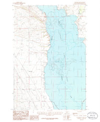
1986 Map of Townsend NE
USGS Topo · Published 1986About this map
The Missouri River corridor north of Townsend dominates this 1980s landscape, where the waters of Canyon Ferry Lake fill the broad valley floor. Along the eastern shoreline, the mouth of Confederate Gulch and the smaller Horse Creek drainage indicate where tributary waters meet the reservoir. This area serves as a point of transition where the historical river course is replaced by the expansive water level at 3797 feet, creating new recreational landmarks like the Campground near the lake's edge. To the west, the terrain rises toward the Elkhorn Mountains, marked by drainage systems such as Whitehorse Creek and the small settlement of Antelope Springs. The presence of a small Cem and several gravel extraction sites like the Gravel Pit suggest a landscape used for both local infrastructure and small-scale community needs amidst the ranching and utility corridors defined by a major transmission line and pipeline.
Find a feature on this map
15 named features on this map. Tap any name to fly to it.
Don’t see what you’re looking for? This feature index may not catch every label — zoom into the map to look around manually.
Map Details
Editions of this 1986 Townsend NE Map
This is the sole edition of this map. No revisions or reprints were ever made.
Other maps of this area

1886 · Fort Logan
USGS Topo · 1:250,000

1948 · White Sulphur Springs
USGS Topo · 1:250,000

1950 · Canyon Ferry
USGS Topo · 1:62,500

1950 · Townsend
USGS Topo · 1:62,500

1950 · Duck Creek Pass
USGS Topo · 1:62,500

1958 · White Sulphur Springs
USGS Topo · 1:250,000

1961 · White Sulphur Springs
USGS Topo · 1:250,000

1965 · White Sulphur Springs
USGS Topo · 1:250,000

1966 · Diamond City
USGS Topo · 1:24,000
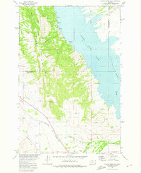
1972 · Canyon Ferry SW
USGS Topo · 1:24,000