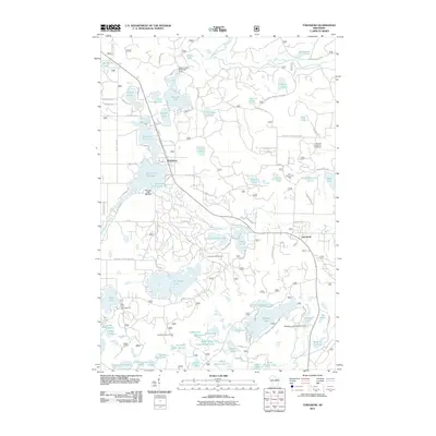
2011 Map of Townsend
USGS Topo · Published 2011About this map
Townsend and Lakewood serve as the primary settlement hubs in this landscape defined by the North Branch Oconto River and a dense network of glacial lakes. Water management is a visible priority here, with infrastructure including the Pickerel Lake 2 WP1430 Dam, Wheeler 2 WP 462 Dam, and the Winslow Lake 3WR1017 Dam regulating the flow through the Townsend Flowage. These water bodies and the surrounding woodlands support a significant recreation economy, evidenced by landmarks like the Paul Bunyon Ski Area and the Bass Lake Recreation Site.
Find a feature on this map
82 named features on this map. Tap any name to fly to it.
Don’t see what you’re looking for? This feature index may not catch every label — zoom into the map to look around manually.
Map Details
Editions of this 2011 Townsend Map
This is the sole edition of this map. No revisions or reprints were ever made.
Other maps of this area

1940 · Thunder Mtn.
USGS Topo · 1:48,000

1942 · Breed
USGS Topo · 1:48,000

1942 · Wabeno
USGS Topo · 1:48,000

1950 · Wabeno
USGS Topo · 1:48,000

1951 · Wabeno
USGS Topo · 1:48,000

1951 · Thunder Mountain
USGS Topo · 1:48,000

1952 · Langlade
USGS Topo · 1:48,000

1952 · Mountain
USGS Topo · 1:48,000

1954 · Iron Mountain
USGS Topo · 1:250,000

1959 · Iron Mountain
USGS Topo · 1:250,000