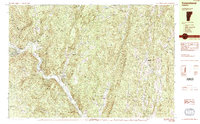
1984 Map of Townshend
USGS Topo · Published 1984About this map
The West River valley serves as the central artery for this Windham County region in the mid-1980s, where small settlements like Townshend and Harmonyville are concentrated along the riverbanks. The landscape is defined by the sharp contrast between the valley floor, which hosts landmarks like the Leland and Gray High Sch and the Town Hall (Round School), and the surrounding ridges. To the west, the Townshend State Forest rises steeply toward Bald Mtn, while the Townshend Reservoir indicates the significant hydrological management in the area.
Find a feature on this map
58 named features on this map. Tap any name to fly to it.
Don’t see what you’re looking for? This feature index may not catch every label — zoom into the map to look around manually.
Map Details
Editions of this 1984 Townshend Map
2 editions found
Other maps of this area

1889 · Wilmington
USGS Topo · 1:62,500

1891 · Wilmington
USGS Topo · 1:62,500

1891 · Brattleboro
USGS Topo · 1:62,500

1893 · Brattleboro
USGS Topo · 1:62,500

1894 · Londonderry
USGS Topo · 1:62,500

1898 · Keene
USGS Topo · 1:62,500

1899 · Londonderry
USGS Topo · 1:62,500

1899 · Wilmington
USGS Topo · 1:62,500

1927 · Bellows Falls
USGS Topo · 1:48,000

1930 · Saxtons River
USGS Topo · 1:48,000