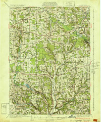
1932 Map of Townville
USGS Topo · Published 1932About this map
Townville serves as a central hub for this rural stretch of Pennsylvania during the early 1930s, where small settlements are connected by a growing network of state highways. The landscape is defined by the headwaters of Sugar Creek and the Pennsylvania RR corridor passing through Tryonville Sta. Genealogists will find an immense amount of detail in the high density of rural schools, including Donation Sch, Root Sch, and Melvin Sch, which once anchored small farming neighborhoods that have since changed. The boundary between Crawford Co and Venango Co divides the map, highlighting the distribution of hamlets like Guys Mill and Dempseytown. Further south, Sugar Lake and landmarks such as Watson Mills illustrate the local reliance on the region's abundant water resources for industry and community life.
Find a feature on this map
90 named features on this map. Tap any name to fly to it.
Don’t see what you’re looking for? This feature index may not catch every label — zoom into the map to look around manually.
Map Details
Editions of this 1932 Townville Map
2 editions found

Other maps of this area

1909 · Franklin
USGS Topo · 1:62,500

1911 · Franklin
USGS Topo · 1:62,500

1911 · Stoneboro
USGS Topo · 1:62,500

1913 · Stoneboro
USGS Topo · 1:62,500

1922 · Oil City
USGS Topo · 1:48,000

1923 · Meadville
USGS Topo · 1:62,500

1923 · Cambridge Springs
USGS Topo · 1:62,500

1924 · Oil City
USGS Topo · 1:62,500

1925 · Meadville
USGS Topo · 1:62,500

1925 · Cambridge Springs
USGS Topo · 1:62,500