
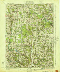
1932 Map of Townville
USGS Topo · Published 1932About this map
Sugar Lake and the winding course of Sugar Creek anchor this rural landscape in the early 1930s, spanning the border of Crawford and Venango Counties. The region is defined by a dense network of crossroads settlements and family-named schools such as Root Sch and Luphen Sch, reflecting a highly localized agrarian society. The northeast corner is marked by the industrial presence of the Pennsylvania railroad serving Tryonville Sta and Centerville, where transit followed the Oil Creek valley.
Find a feature on this map
105 named features on this map. Tap any name to fly to it.
Don’t see what you’re looking for? This feature index may not catch every label — zoom into the map to look around manually.
Map Details
Editions of this 1932 Townville Map
2 editions found
Other maps of this area

1909 · Franklin
USGS Topo · 1:62,500

1911 · Franklin
USGS Topo · 1:62,500

1911 · Stoneboro
USGS Topo · 1:62,500

1913 · Stoneboro
USGS Topo · 1:62,500

1922 · Oil City
USGS Topo · 1:48,000

1923 · Meadville
USGS Topo · 1:62,500

1923 · Cambridge Springs
USGS Topo · 1:62,500

1924 · Oil City
USGS Topo · 1:62,500

1925 · Meadville
USGS Topo · 1:62,500

1925 · Cambridge Springs
USGS Topo · 1:62,500