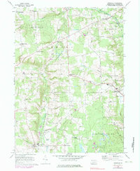
1967 Map of Townville
USGS Topo · Published 1983About this map
The borough of Townville and the surrounding township lands of Crawford County define this topographic study, reflecting a landscape shaped by glacial topography and agricultural heritage. Numerous "corners" settlements—like Jewel Corners, Oregon Corners, and Basil Corners—mark the intersection of rural life and transit, often anchored by family names that signify the region's 19th-century genealogical roots. To the southwest, the Erie National Wildlife Refuge preserves the wetland environments around Woodcock Creek, while several State Game Lands No 146 tracts highlight the priority of conservation and public recreation in the area. Local institutions such as the Union Church and multiple family burial grounds, including Smith Cemetery and Bentley Cemetery, provide specific touchstones for those tracing the history of the Richmond, Athens, and Steuben townships.
Find a feature on this map
52 named features on this map. Tap any name to fly to it.
Don’t see what you’re looking for? This feature index may not catch every label — zoom into the map to look around manually.
Map Details
Editions of this 1967 Townville Map

Other maps of this area

1923 · Meadville
USGS Topo · 1:62,500

1923 · Cambridge Springs
USGS Topo · 1:62,500

1925 · Meadville
USGS Topo · 1:62,500

1925 · Cambridge Springs
USGS Topo · 1:62,500

1927 · Townville
USGS Topo · 1:48,000

1929 · Union City
USGS Topo · 1:62,500

1932 · Townville
USGS Topo · 1:62,500

1932 · Union City
USGS Topo · 1:62,500

1943 · Meadville
USGS Topo · 1:62,500

1943 · Cambridge Springs
USGS Topo · 1:62,500