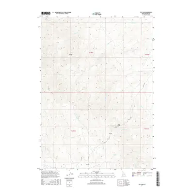
2017 Map of Toy Pass
USGS Topo · Published 2017About this map
The Silver City Range dominates this high-elevation landscape in southwestern Idaho, where the Owyhee Mountains transition through sharp ridges and deep creek drainages. Movement through this complex terrain is defined by historic passages like Toy Pass and the steep descent of the Bachman Grade to the east. The geography is punctuated by specific summits such as Red Mtn and Henderson Point, while a high-plateau relief appears at Toy Flat.
Find a feature on this map
32 named features on this map. Tap any name to fly to it.
Don’t see what you’re looking for? This feature index may not catch every label — zoom into the map to look around manually.
Map Details
Editions of this 2017 Toy Pass Map
This is the sole edition of this map. No revisions or reprints were ever made.
Other maps of this area

1892 · Bisuka
USGS Topo · 1:125,000

1892 · Silver City
USGS Topo · 1:125,000

1894 · Bisuka
USGS Topo · 1:125,000

1894 · Silver City
USGS Topo · 1:125,000

1898 · Silver City
USGS Topo · 1:125,000

1949 · Oreana
USGS Topo · 1:62,500
1949 · Oreana
USGS Topo · 1:24,000
1950 · Oreana
USGS Topo · 1:24,000

1955 · Jordan Valley
USGS Topo · 1:250,000

1955 · Boise
USGS Topo · 1:250,000