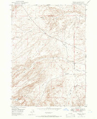
1949 Map of Oreana
USGS Topo · Published 1966About this map
Oreana serves as the primary focal point of this high-desert Owyhee County landscape, situated where the high plains meet the intricate drainage systems of the Snake River plain. The 1949 field check captures the settlement's core infrastructure, including the Oreana School, a Post Office, and a nearby Cemetery, all positioned near the intersection of various canyon-carving waterways. The arid character of the region is evident through the presence of a Windmill and the Little Hart Reservoir, indicating the vital importance of water management for local ranching and life.
Find a feature on this map
16 named features on this map. Tap any name to fly to it.
Don’t see what you’re looking for? This feature index may not catch every label — zoom into the map to look around manually.
Map Details
Editions of this 1949 Oreana Map
2 editions found
Other maps of this area

1892 · Bisuka
USGS Topo · 1:125,000

1892 · Silver City
USGS Topo · 1:125,000

1894 · Bisuka
USGS Topo · 1:125,000

1894 · Silver City
USGS Topo · 1:125,000

1898 · Silver City
USGS Topo · 1:125,000

1947 · Wild Horse Butte
USGS Topo · 1:24,000

1948 · Castle Butte
USGS Topo · 1:24,000

1948 · Wild Horse Butte
USGS Topo · 1:24,000

1948 · Sinker Butte
USGS Topo · 1:24,000

1949 · Sinker Butte
USGS Topo · 1:24,000