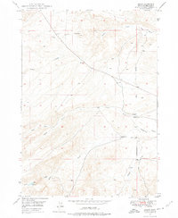
1949 Map of Oreana
USGS Topo · Published 1975About this map
Oreana sits at the junction of several critical watercourses in Owyhee County, providing a glimpse into the late 1940s ranching and settlement patterns of this arid Idaho landscape. The map centers on the small community and its essential local institutions, including the Oreana School and the nearby Cem, which serve as vital markers for family history researchers. The Boise Meridian cuts through the eastern portion of the sheet, organizing the vast network of drainage basins like Fossil Creek and Picket Creek that flow toward the lower elevations. To the northwest, Fossil Butte dominates the terrain, while the Little Hart Reservoir and a lone Windmill near Brown Creek underscore the importance of water management in this high-desert environment. These features, along with several scattered gravel pits, illustrate a landscape primarily shaped by rural infrastructure and natural geographic boundaries.
Find a feature on this map
16 named features on this map. Tap any name to fly to it.
Don’t see what you’re looking for? This feature index may not catch every label — zoom into the map to look around manually.
Map Details
Editions of this 1949 Oreana Map
2 editions found
Other maps of this area

1892 · Bisuka
USGS Topo · 1:125,000

1892 · Silver City
USGS Topo · 1:125,000

1894 · Bisuka
USGS Topo · 1:125,000

1894 · Silver City
USGS Topo · 1:125,000

1898 · Silver City
USGS Topo · 1:125,000

1947 · Wild Horse Butte
USGS Topo · 1:24,000

1948 · Castle Butte
USGS Topo · 1:24,000

1948 · Wild Horse Butte
USGS Topo · 1:24,000

1948 · Sinker Butte
USGS Topo · 1:24,000

1949 · Sinker Butte
USGS Topo · 1:24,000