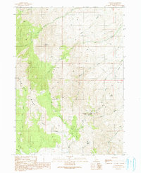
1990 Map of Toy Pass
USGS Topo · Published 1991About this map
The Silver City Range dominates this 1990 survey of the Owyhee high country, where high-altitude peaks and drainage systems define the landscape. Notable elevations like Red Mountain and Henderson Point overlook a complex network of canyons and gulches, including Castle Creek and Bates Creek. The map documents a rugged environment where water sources were critical for both survival and industry, marked by the location of Alibi Spring, Henderson Springs, and Charity Spring.
Find a feature on this map
32 named features on this map. Tap any name to fly to it.
Don’t see what you’re looking for? This feature index may not catch every label — zoom into the map to look around manually.
Map Details
Editions of this 1990 Toy Pass Map
This is the sole edition of this map. No revisions or reprints were ever made.
Other maps of this area

1892 · Bisuka
USGS Topo · 1:125,000

1892 · Silver City
USGS Topo · 1:125,000

1894 · Bisuka
USGS Topo · 1:125,000

1894 · Silver City
USGS Topo · 1:125,000

1898 · Silver City
USGS Topo · 1:125,000

1949 · Oreana
USGS Topo · 1:62,500
1949 · Oreana
USGS Topo · 1:24,000
1950 · Oreana
USGS Topo · 1:24,000

1955 · Jordan Valley
USGS Topo · 1:250,000

1955 · Boise
USGS Topo · 1:250,000