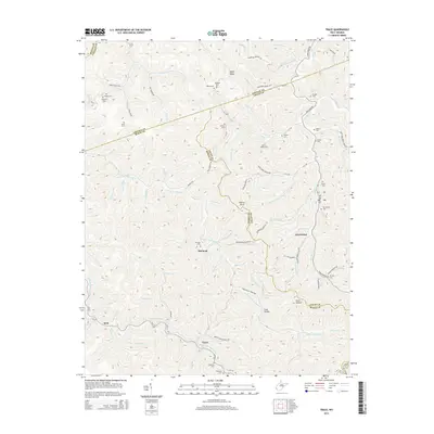
2014 Map of Trace
USGS Topo · Published 2014About this map
E Fork Twelvepole Cr and its many winding tributaries dictate the landscape and human settlement patterns of this 2014 survey. This portion of the Appalachian coalfields is defined by small, valley-bottom communities like Whirlwind, McCloud, and Trace, which follow the narrow paths carved by the water. The map serves as a significant record of regional family history, documenting numerous small burial grounds including Mullins Adams Cem, Kinser Cem, and Sol Adams Cem. The terrain is characterized by prominent high points such as Hoover Knob and Bryan Ridge, with the county lines of Lincoln, Logan, and Mingo counties intersecting in a complex web of ridges. The road network, including Mud Fork Rd and Copley Trace Rd, follows the natural contours of the hollers, illustrating how the geography has historically shaped local travel.
Find a feature on this map
104 named features on this map. Tap any name to fly to it.
Don’t see what you’re looking for? This feature index may not catch every label — zoom into the map to look around manually.
Map Details
Editions of this 2014 Trace Map
This is the sole edition of this map. No revisions or reprints were ever made.
Other maps of this area

1887 · Warfield
USGS Topo · 1:125,000

1891 · Warfield
USGS Topo · 1:125,000

1892 · Huntington
USGS Topo · 1:125,000

1898 · Huntington
USGS Topo · 1:125,000

1902 · Midkiff
USGS Topo · 1:62,500

1907 · Midkiff
USGS Topo · 1:62,500

1909 · Wayne
USGS Topo · 1:62,500

1909 · Midkiff
USGS Topo · 1:62,500

1910 · Holden
USGS Topo · 1:48,000

1910 · Naugatuck
USGS Topo · 1:48,000