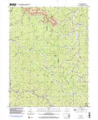
1997 Map of Trace
USGS Topo · Published 2003About this map
The Guyandotte River valley and its surrounding ridges define this landscape along the border of Mingo, Logan, and Lincoln counties. In the late 1990s, the terrain remained marked by a dense network of mountain hollows and the enduring legacy of rural education and faith, seen in the numerous combined church-school sites and family burial grounds that dot the ridges. The settlement of Trace sits near the headwaters of Twelvepole Creek, while the village of Hoover occupies a bend in the river to the south.
Find a feature on this map
92 named features on this map. Tap any name to fly to it.
Don’t see what you’re looking for? This feature index may not catch every label — zoom into the map to look around manually.
Map Details
Editions of this 1997 Trace Map
This is the sole edition of this map. No revisions or reprints were ever made.
Other maps of this area

1887 · Warfield
USGS Topo · 1:125,000

1891 · Warfield
USGS Topo · 1:125,000

1892 · Huntington
USGS Topo · 1:125,000

1898 · Huntington
USGS Topo · 1:125,000

1902 · Midkiff
USGS Topo · 1:62,500

1907 · Midkiff
USGS Topo · 1:62,500

1909 · Wayne
USGS Topo · 1:62,500

1909 · Midkiff
USGS Topo · 1:62,500

1910 · Holden
USGS Topo · 1:48,000

1910 · Naugatuck
USGS Topo · 1:48,000