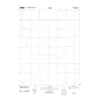
2012 Map of Tractor
USGS Topo · Published 2012About this map
Tractor serves as the namesake reference point for this western Kansas landscape, which is defined by a rigorous grid of section lines and rural thoroughfares. The terrain exhibits the orderly development of the High Plains, where agricultural land is partitioned by long straightaways such as N Navaho Rd and N Pawnee Rd. This 2012 survey by the U.S. Geological Survey documents the spatial organization of Scott County, highlighting a network of roads named for various historical and tribal associations, including S Rodeo Rd, S Taos Rd, and S Quiviera Rd. The concentration of infrastructure around Pitman Ln suggests localized activity within an otherwise expansive, agrarian territory. The map is a precise record of the road naming conventions and land divisions that characterize the region north of the county seat in the early twenty-first century.
Find a feature on this map
17 named features on this map. Tap any name to fly to it.
Don’t see what you’re looking for? This feature index may not catch every label — zoom into the map to look around manually.
Map Details
Editions of this 2012 Tractor Map
This is the sole edition of this map. No revisions or reprints were ever made.
Other maps of this area

1939 · Sandon
USGS Topo · 1:62,500

1940 · Scott City
USGS Topo · 1:62,500

1942 · Sandon
USGS Topo · 1:62,500

1951 · Scott City
USGS Topo · 1:62,500

1955 · Scott City
USGS Topo · 1:250,000

1958 · Scott City
USGS Topo · 1:250,000

1974 · Amy SW
USGS Topo · 1:24,000

1974 · Grigston
USGS Topo · 1:24,000

1974 · Manning
USGS Topo · 1:24,000
1976 · Shallow Water
USGS Topo · 1:24,000