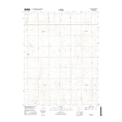
2015 Map of Tractor
USGS Topo · Published 2015About this map
White Woman Basin dominates the western portion of this Scott County landscape, illustrating the unique closed-basin hydrology characteristic of the High Plains. The small settlement of Tractor sits in the northern reaches, serving as a focal point for the surrounding agricultural grid. The map reveals a strictly organized section-line road system, where routes like N Pawnee Rd and S Quiviera Rd facilitate access across the expansive terrain of T18S and T19S. Numerous unnamed ephemeral ponds and depressions are scattered throughout the quadrangle, highlighting the subtle elevation changes within this prairie environment. This 2015 survey provides a clear view of modern land divisions and water catchment areas that have defined Western Kansas farming and ranching for generations.
Find a feature on this map
25 named features on this map. Tap any name to fly to it.
Don’t see what you’re looking for? This feature index may not catch every label — zoom into the map to look around manually.
Map Details
Editions of this 2015 Tractor Map
This is the sole edition of this map. No revisions or reprints were ever made.
Other maps of this area

1939 · Sandon
USGS Topo · 1:62,500

1940 · Scott City
USGS Topo · 1:62,500

1942 · Sandon
USGS Topo · 1:62,500

1951 · Scott City
USGS Topo · 1:62,500

1955 · Scott City
USGS Topo · 1:250,000

1958 · Scott City
USGS Topo · 1:250,000

1974 · Amy SW
USGS Topo · 1:24,000

1974 · Grigston
USGS Topo · 1:24,000

1974 · Manning
USGS Topo · 1:24,000
1976 · Shallow Water
USGS Topo · 1:24,000