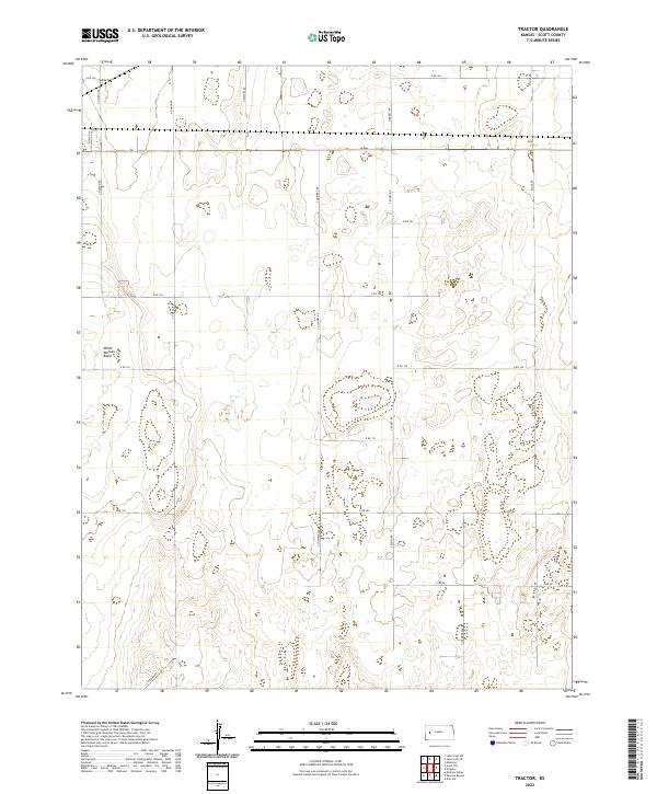
2022 Map of Tractor
USGS Topo · Published 2022About this map
White Woman Basin characterizes this landscape in western Kansas, where the high plains terrain is marked by numerous ephemeral depressions and a strictly organized grid of agricultural roads. This area of Scott County reveals a modern land management system where thoroughfares like N Navaho Rd and S Quiviera Rd define the boundaries between vast sections of farmland. The geography is notably sparse, focused on the utility of the land rather than dense settlement. The grid, anchored by routes such as N Pawnee Rd and S Shawnee Rd, facilitates movement through a region where natural drainage patterns and small basins are the primary topographical interruptions. Local genealogists and researchers can trace land divisions across the townships of T18S R32W and T19S R31W, observing how the modern infrastructure overlays the historic Public Land Survey System.
Find a feature on this map
24 named features on this map. Tap any name to fly to it.
Don’t see what you’re looking for? This feature index may not catch every label — zoom into the map to look around manually.
Map Details
Editions of this 2022 Tractor Map
This is the sole edition of this map. No revisions or reprints were ever made.
Other maps of this area

1939 · Sandon
USGS Topo · 1:62,500

1940 · Scott City
USGS Topo · 1:62,500

1942 · Sandon
USGS Topo · 1:62,500

1951 · Scott City
USGS Topo · 1:62,500

1955 · Scott City
USGS Topo · 1:250,000

1958 · Scott City
USGS Topo · 1:250,000

1974 · Amy SW
USGS Topo · 1:24,000

1974 · Grigston
USGS Topo · 1:24,000

1974 · Manning
USGS Topo · 1:24,000
1976 · Shallow Water
USGS Topo · 1:24,000