
1916 Map of Tracy
USGS Topo · Published 1916About this map
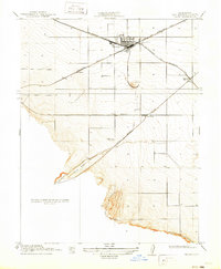
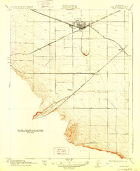
The railroad junction at Tracy serves as the focal point for this 1912 survey, where the Southern Pacific and Western Pacific networks converge. This era shows the San Joaquin Valley’s transition into a vital transportation hub, with long-distance routes like the Niles and Sacramento Line and the San Francisco and New Orleans Line intersecting near the town center. Small agricultural and transit points such as Ellis and Lyoth are positioned along these corridors, while the Tesla Branch strikes southwest toward the foothills.
Find a feature on this map
11 named features on this map. Tap any name to fly to it.
Don’t see what you’re looking for? This feature index may not catch every label — zoom into the map to look around manually.
Map Details
Editions of this 1916 Tracy Map
3 editions found
Other maps of this area

1907 · Tesla
USGS Topo · 1:62,500

1913 · Romain
USGS Topo · 1:31,680

1914 · Bethany
USGS Topo · 1:31,680

1914 · Union Island
USGS Topo · 1:31,680

1915 · Vernalis
USGS Topo · 1:31,680

1915 · Lathrop
USGS Topo · 1:31,680

1916 · Byron
USGS Topo · 1:62,500

1916 · Romain
USGS Topo · 1:31,680

1916 · Midway
USGS Topo · 1:31,680

1922 · Carbona
USGS Topo · 1:62,500