
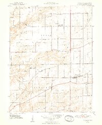
1948 Map of Trafalgar
USGS Topo · Published 1948About this map
The town of Trafalgar serves as the primary hub on this mid-century survey of rural Johnson County, situated at the intersection of a significant rail network. The New York Central railroad cuts through the heart of the community, while the Illinois Central corridor runs further west, illustrating the vital role of rail transport in the local agricultural economy. The landscape is dotted with smaller crossroads settlements like Samaria, Anita, and Bud, each serving its immediate township with essential institutions.
Find a feature on this map
34 named features on this map. Tap any name to fly to it.
Don’t see what you’re looking for? This feature index may not catch every label — zoom into the map to look around manually.
Map Details
Editions of this 1948 Trafalgar Map
2 editions found
Other maps of this area

1942 · Franklin
USGS Topo · 1:125,000

1947 · Franklin
USGS Topo · 1:62,500

1948 · Franklin
USGS Topo · 1:24,000

1948 · Nineveh
USGS Topo · 1:24,000

1948 · Fruitdale
USGS Topo · 1:24,000

1948 · Morgantown
USGS Topo · 1:24,000

1950 · Morgantown
USGS Topo · 1:24,000

1950 · Franklin
USGS Topo · 1:62,500

1952 · Bargersville
USGS Topo · 1:24,000

1953 · Greenwood
USGS Topo · 1:24,000