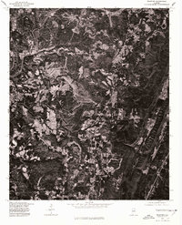
1975 Map of Trafford
USGS Topo · Published 1977About this map
Trafford serves as the central anchor of this 1975 orthophotograph, captured through aerial photography in cooperation with the Soil Conservation Service. The imagery provides a clear view of the north-central Alabama landscape, dominated by a winding watercourse labeled as Locus. Unlike a traditional topographic map, this photographic record reveals the actual land use and vegetation patterns of the era, showing the distinct contrast between dense wooded areas and cleared parcels of land. The intricate texture of the terrain and the layout of local roads near the settlement offer a direct visual record of the physical environment as it existed in the mid-1970s. This specific survey is particularly useful for observing how development and natural features like the Locus interacted before further modern expansion.
Find a feature on this map
2 named features on this map. Tap any name to fly to it.
Don’t see what you’re looking for? This feature index may not catch every label — zoom into the map to look around manually.
Map Details
Editions of this 1975 Trafford Map
This is the sole edition of this map. No revisions or reprints were ever made.
Other maps of this area

1889 · Birmingham
USGS Topo · 1:125,000

1892 · Birmingham
USGS Topo · 1:125,000

1895 · Birmingham
USGS Topo · 1:125,000

1904 · Birmingham Coal District
USGS Topo · 1:62,500

1905 · Leeds
USGS Topo · 1:62,500

1906 · Birmingham Special
USGS Topo · 1:62,500

1907 · Birmingham
USGS Topo · 1:125,000

1907 · Leeds
USGS Topo · 1:62,500

1951 · Warrior
USGS Topo · 1:24,000

1951 · Blount Springs
USGS Topo · 1:24,000