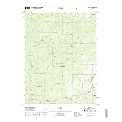
2018 Map of Tragedy Spring
USGS Topo · Published 2018About this map
Tragedy Spring and the nearby Maiden's Grave stand as significant historical markers along the high ridgelines of the Eldorado National Forest. Situated on the border of El Dorado and Amador Counties, this terrain is defined by a dense network of high-altitude meadows such as Government Meadow, Convict Meadow, and Jake Schneider Meadow. The landscape is carved by the Silver Fork American River and its tributaries, including Caples Creek and Tragedy Creek, which flow through steep features like Sherman Canyon and Negro Canyon.
Find a feature on this map
66 named features on this map. Tap any name to fly to it.
Don’t see what you’re looking for? This feature index may not catch every label — zoom into the map to look around manually.
Map Details
Editions of this 2018 Tragedy Spring Map
This is the sole edition of this map. No revisions or reprints were ever made.
Other maps of this area

1889 · Pyramid Peak
USGS Topo · 1:125,000

1891 · Pyramid Peak
USGS Topo · 1:125,000

1895 · Pyramid Peak
USGS Topo · 1:125,000

1896 · Pyramid Peak
USGS Topo · 1:125,000

1947 · Sacramento
USGS Topo · 1:250,000

1948 · Sacramento
USGS Topo · 1:250,000

1951 · Leek Spring Hill
USGS Topo · 1:24,000
1951 · Peddler Hill
USGS Topo · 1:24,000
1951 · Leek Spring Hill
USGS Topo · 1:62,500
1952 · Kyburz
USGS Topo · 1:24,000