
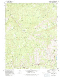
1992 Map of Tragedy Spring
USGS Topo · Published 1994About this map
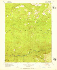
The Tragedy Spring Grave and nearby Maidens Grave anchor this portion of the El Dorado National Forest, serving as somber reminders of the hardships faced along early pioneer trails. The terrain is defined by the high-elevation drainage of the Silver Fork American River and the Cosumnes River North Fork Leek Spring Valley, where numerous meadows and flats like Government Meadow and Negro Flat provided critical respite for travelers.
Find a feature on this map
52 named features on this map. Tap any name to fly to it.
Don’t see what you’re looking for? This feature index may not catch every label — zoom into the map to look around manually.
Map Details
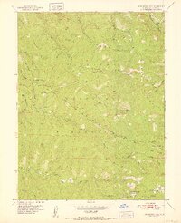
Editions of this 1992 Tragedy Spring Map
2 editions found
Other maps of this area

1889 · Pyramid Peak
USGS Topo · 1:125,000

1891 · Pyramid Peak
USGS Topo · 1:125,000

1895 · Pyramid Peak
USGS Topo · 1:125,000

1896 · Pyramid Peak
USGS Topo · 1:125,000

1947 · Sacramento
USGS Topo · 1:250,000

1948 · Sacramento
USGS Topo · 1:250,000
1951 · Leek Spring Hill
USGS Topo · 1:24,000
1951 · Peddler Hill
USGS Topo · 1:24,000
1951 · Leek Spring Hill
USGS Topo · 1:62,500
1952 · Kyburz
USGS Topo · 1:24,000