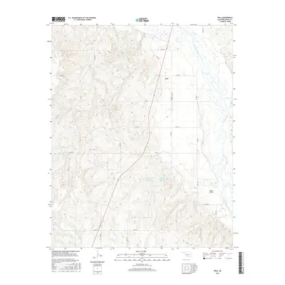
2016 Map of Trail
USGS Topo · Published 2016About this map
The Canadian River dominates the eastern edge of this Dewey County landscape, its wide, braided channel carving through the plains near Trail. This rural settlement is anchored by the Trail Cem, providing a focal point for local genealogical research in this sparsely populated region. The topography is defined by significant drainage systems, including Red Cr and North Big Quartermaster Cr, which feed into the larger river basin. Water management is evident through the Fitzgerald-Soldier Site 1 Reservoir and its companion, Fitzgerald-Soldier Site 2 Reservoir, reflecting the importance of agricultural water conservation. Landforms like Mouse Hollow add character to the terrain, while a network of rural roads such as e0740 RD and n2080 RD connect isolated farmsteads across the rolling Oklahoma prairie.
Find a feature on this map
27 named features on this map. Tap any name to fly to it.
Don’t see what you’re looking for? This feature index may not catch every label — zoom into the map to look around manually.
Map Details
Editions of this 2016 Trail Map
This is the sole edition of this map. No revisions or reprints were ever made.
Other maps of this area

1955 · Clinton
USGS Topo · 1:250,000

1955 · Woodward
USGS Topo · 1:250,000

1957 · Clinton
USGS Topo · 1:250,000

1958 · Woodward
USGS Topo · 1:250,000

1961 · Leedey
USGS Topo · 1:62,500

1962 · Aledo
USGS Topo · 1:62,500

1969 · Mutual SW
USGS Topo · 1:24,000

1969 · Camargo
USGS Topo · 1:24,000
1970 · Vici SW
USGS Topo · 1:24,000

1984 · Foss Reservoir
USGS Topo · 1:100,000