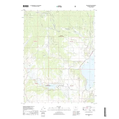
2019 Map of Trail Mountain
USGS Topo · Published 2019About this map
Arapaho National Forest dominates this high-altitude landscape in Grand County, where complex water management systems dictate the valley's character. The presence of the Willow Creek Reservoir and the western edge of Lake Granby highlights the area's role in regional water storage, supported by an intricate network of irrigation and diversion works like the Red Top Valley Ditch, Bunte Highline Ditch, and Willow Creek Pump Canal. These man-made features contrast with the natural peaks of Trail Mountain and Apiatan Mountain.
Find a feature on this map
79 named features on this map. Tap any name to fly to it.
Don’t see what you’re looking for? This feature index may not catch every label — zoom into the map to look around manually.
Map Details
Editions of this 2019 Trail Mountain Map
This is the sole edition of this map. No revisions or reprints were ever made.
Other maps of this area

1915 · Longs Peak
USGS Topo · 1:125,000

1919 · Rocky Mountain National Park
USGS Topo · 1:125,000

1954 · Greeley
USGS Topo · 1:250,000

1954 · Craig
USGS Topo · 1:250,000

1956 · Radial Mountain
USGS Topo · 1:24,000

1956 · Rand
USGS Topo · 1:62,500

1957 · Craig
USGS Topo · 1:250,000

1957 · Greeley
USGS Topo · 1:250,000

1957 · Bowen Mountain
USGS Topo · 1:24,000
1957 · Trail Mountain
USGS Topo · 1:24,000