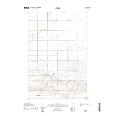
2019 Map of Trail
USGS Topo · Published 2019About this map
The small settlements of Trail and Gully anchor this northern Minnesota landscape along the border of Red Lake and Polk Counties. The terrain is defined by a dense network of drainage infrastructure, including Judicial Ditch Number Seventy-two and County Ditch Number Eighty-nine, which manage the water flow across the relatively flat plains near the Lost River. For genealogists and local historians, the sheet is particularly valuable for its documentation of several rural burial grounds, such as Mount Olive Cem, Valley Lutheran Cem, and the Saint Charles Borromeo Catholic Cem. Transport through the area is facilitated by Soo Ave and a grid of county roads, while natural features like Breeze Lake punctuate the southern sections of the quadrangle. This map reflects the agricultural character and religious heritage of the Red River Valley region.
Find a feature on this map
36 named features on this map. Tap any name to fly to it.
Don’t see what you’re looking for? This feature index may not catch every label — zoom into the map to look around manually.
Map Details
Editions of this 2019 Trail Map
This is the sole edition of this map. No revisions or reprints were ever made.
Other maps of this area

1919 · Fosston
USGS Topo · 1:62,500

1919 · Grit
USGS Topo · 1:62,500

1919 · Winsor
USGS Topo · 1:62,500

1954 · Bemidji
USGS Topo · 1:250,000

1957 · Bemidji
USGS Topo · 1:250,000

1958 · Bemidji
USGS Topo · 1:250,000

1969 · Olga
USGS Topo · 1:24,000

1969 · Mc Intosh NE
USGS Topo · 1:24,000

1969 · Gonvick
USGS Topo · 1:24,000
1971 · Oklee
USGS Topo · 1:24,000