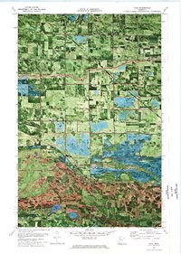
1972 Map of Trail
USGS Topo · Published 1976About this map
Trail and the surrounding borderlands of Polk and Red Lake Counties are depicted in this 1972 orthophotomap, which combines aerial photography with topographic data. The settlement is centered near the Indian Reservation Line, marking a point where agricultural land meets the protected expanse of the Hill River State Wildlife Management Area. The landscape is defined by an extensive drainage network, including Judicial Ditch No 72 and County Ditch No 89, which redirect water toward the Lost River to support local farming operations like the Rice Field. Cultural landmarks such as St Charles Ch and Mt Olive Cem provide critical touchpoints for genealogists researching family ties in Gully and Chester townships. Numerous gravel pits and a Quarry suggest a local economy tied to the land's geological resources, while Breeze Lake offers a natural contrast to the industrial and agricultural modifications of the terrain.
Find a feature on this map
24 named features on this map. Tap any name to fly to it.
Don’t see what you’re looking for? This feature index may not catch every label — zoom into the map to look around manually.
Map Details
Editions of this 1972 Trail Map
This is the sole edition of this map. No revisions or reprints were ever made.
Other maps of this area

1919 · Fosston
USGS Topo · 1:62,500

1919 · Grit
USGS Topo · 1:62,500

1919 · Winsor
USGS Topo · 1:62,500

1954 · Bemidji
USGS Topo · 1:250,000

1957 · Bemidji
USGS Topo · 1:250,000

1958 · Bemidji
USGS Topo · 1:250,000

1969 · Olga
USGS Topo · 1:24,000

1969 · Mc Intosh NE
USGS Topo · 1:24,000

1969 · Gonvick
USGS Topo · 1:24,000
1971 · Oklee
USGS Topo · 1:24,000