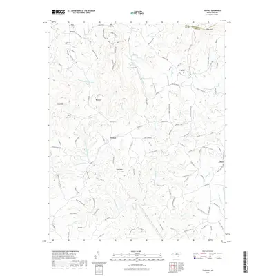
2019 Map of Traphill
USGS Topo · Published 2019About this map
Greenstreets Mtn and Carters Mtn overlook a complex network of waterways that define the northern Wilkes County landscape. The area is characterized by several distinct mountain gaps, including Pole Bridge Gap and Martins Low Gap along the boundary with Alleghany County. Small settlements such as Abshers, Moxley, and Dockery are connected by a web of narrow roads that follow the winding paths of the Middle Prong Roaring River and the East Prong Roaring River. Local history is preserved at the Double Creek Cem and Truitt Cem, which sit near the northern edge of the survey. The terrain transitions from high peaks like Bucks Peak and Combs Knob in the north to the more open reaches of Wiles Ridge as the waters converge into the main channel of the Roaring River.
Find a feature on this map
126 named features on this map. Tap any name to fly to it.
Don’t see what you’re looking for? This feature index may not catch every label — zoom into the map to look around manually.
Map Details
Editions of this 2019 Traphill Map
This is the sole edition of this map. No revisions or reprints were ever made.
Other maps of this area

1889 · Wilkesboro
USGS Topo · 1:125,000

1891 · Wilkesboro
USGS Topo · 1:125,000

1891 · Yadkinville
USGS Topo · 1:125,000

1893 · Yadkinville
USGS Topo · 1:125,000

1953 · Winston-Salem
USGS Topo · 1:250,000

1955 · Winston-Salem
USGS Topo · 1:250,000

1962 · Winston-Salem
USGS Topo · 1:250,000

1966 · Roaring River
USGS Topo · 1:24,000

1966 · Wilkesboro
USGS Topo · 1:24,000
1968 · Glade Valley
USGS Topo · 1:24,000