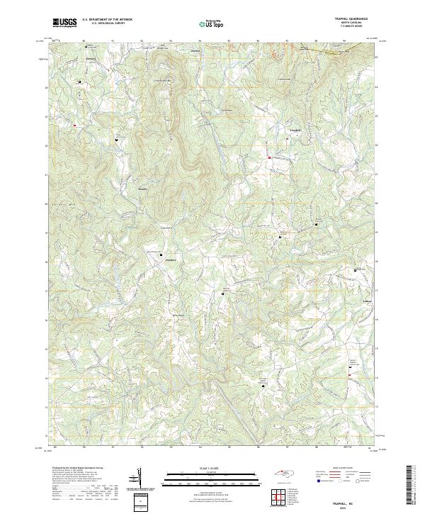
2022 Map of Traphill
USGS Topo · Published 2022About this map
Traphill and the surrounding Blue Ridge foothills in northern Wilkes County are defined by a complex network of waterways, where the Roaring River is fed by the Middle Prong Roaring River, W Prong Roaring River, and E Prong Roaring River. The topography is marked by significant elevations such as Greenstreets Mtn, Combs Knob, and Twin Knobs, with the Alleghany Co Wilkes Co boundary following the high ridges in the north. Settlement is dispersed along the winding roads that follow the valley floors and ridgelines, connecting small communities like Dockery, Lomax, and Joynes. Genealogists will find a high density of burial sites throughout the landscape, including the New Light Baptist Church Cem, Rachel Baptist Church Cem, and several family-named locations such as Billings Hill Cem and Truitt Cem, reflecting the deep-rooted family histories of this rural North Carolina region.
Find a feature on this map
132 named features on this map. Tap any name to fly to it.
Don’t see what you’re looking for? This feature index may not catch every label — zoom into the map to look around manually.
Map Details
Editions of this 2022 Traphill Map
This is the sole edition of this map. No revisions or reprints were ever made.
Other maps of this area

1889 · Wilkesboro
USGS Topo · 1:125,000

1891 · Wilkesboro
USGS Topo · 1:125,000

1891 · Yadkinville
USGS Topo · 1:125,000

1893 · Yadkinville
USGS Topo · 1:125,000

1953 · Winston-Salem
USGS Topo · 1:250,000

1955 · Winston-Salem
USGS Topo · 1:250,000

1962 · Winston-Salem
USGS Topo · 1:250,000

1966 · Roaring River
USGS Topo · 1:24,000

1966 · Wilkesboro
USGS Topo · 1:24,000
1968 · Glade Valley
USGS Topo · 1:24,000